


Co-written by Sarah Herron and Morgan Tilton
Going on a road trip gives us a nimbleness as travelers to indulge in pockets of experiential moments. We can plan a route yet leave room to be spontaneous. And we’re given a front-row seat to observe the nooks and crannies of our diverse country, which is why I love road trips!
You can make pit stops in communities and pick up cultural nuances. You can swing into local restaurants, taste new foods you may not eat otherwise, and pull over at random lookout points. You can study architecture, landscapes, weather, flora, and fauna that can’t be seen from an airplane. You learn the lay of the land. You can blend outdoor recreation with luxury and slow time. And as you pass through stunning locations, you gather inspiration and ideas for the next road trip, too.
Road tripping is such a timeless, fun way to open ourselves to the nation’s distinct regions, outdoor spaces, history, and lifestyles. To spark your wanderlust and help script your next route, here are my top five favorite road trips of the West.
Note: You can condense or extend the duration of each trip. And these circuits start in Carbondale, CO, with my partner Dylan Brown.
*When camping and recreating, be sure to check for local fire bans–which can change daily–adhere to Leave No Trace principles, comply with state and county COVID-19 regulations, respect indigenous practices, and follow local guidelines.
BUT FIRST, THE RIG
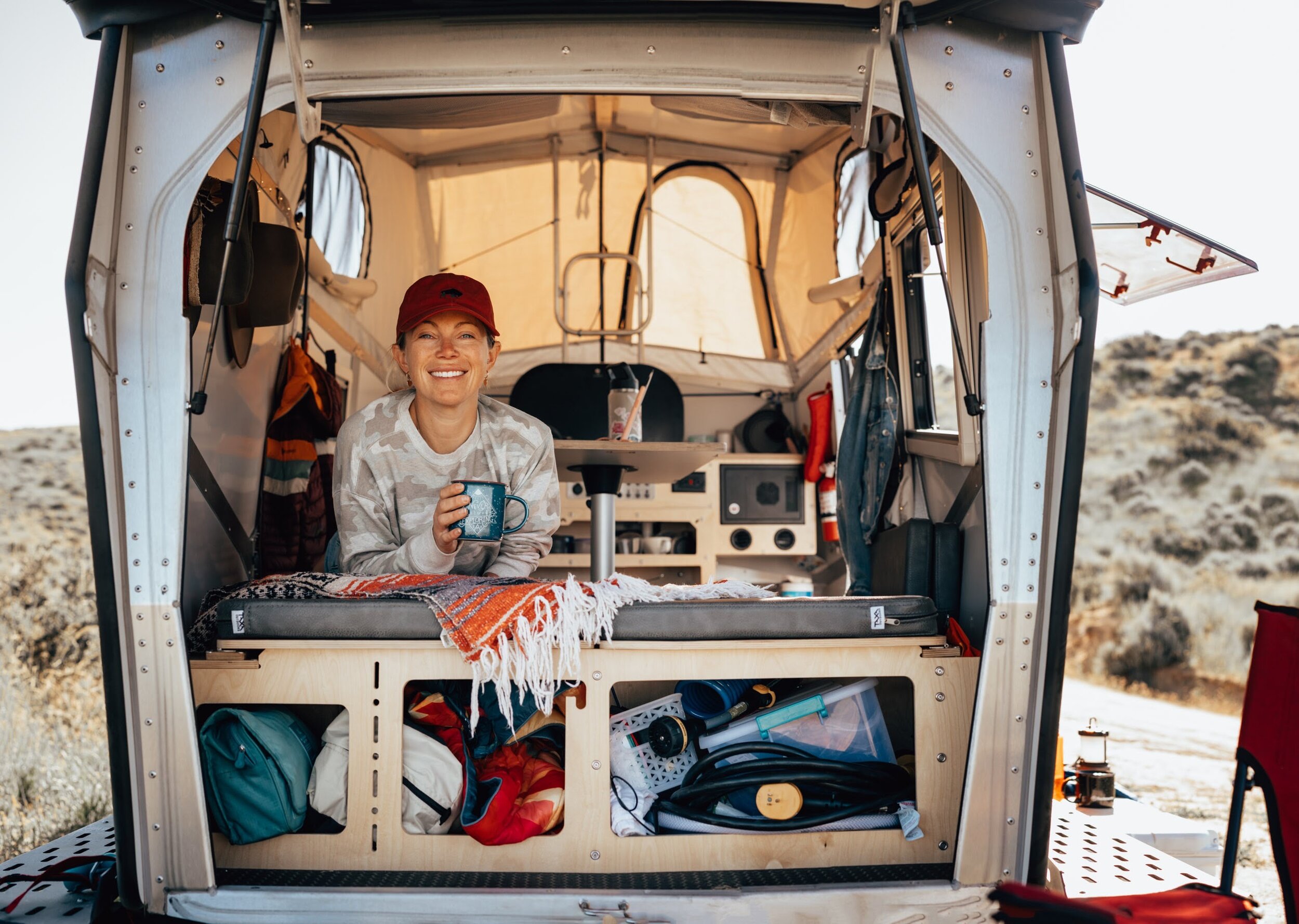
For longer trips, Dylan and I like to hop in a trailer or something that can bring the comforts of home on longer stretches on the road. Below are two of the trailer’s we’ve spent extended periods exploring the US in, and would highly recommend! Though any of these itineraries are doable by car whether you are camping or staying in Airbnb’s.
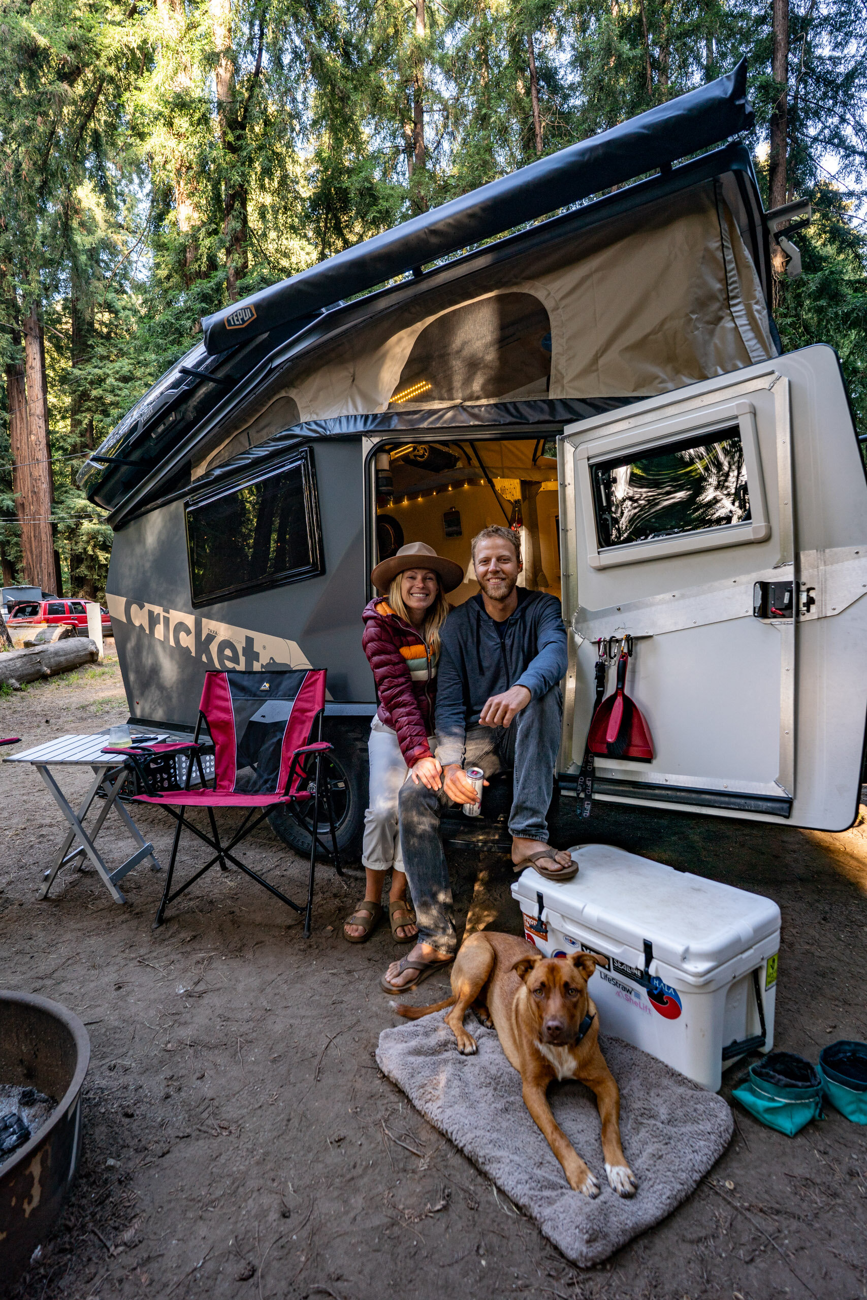
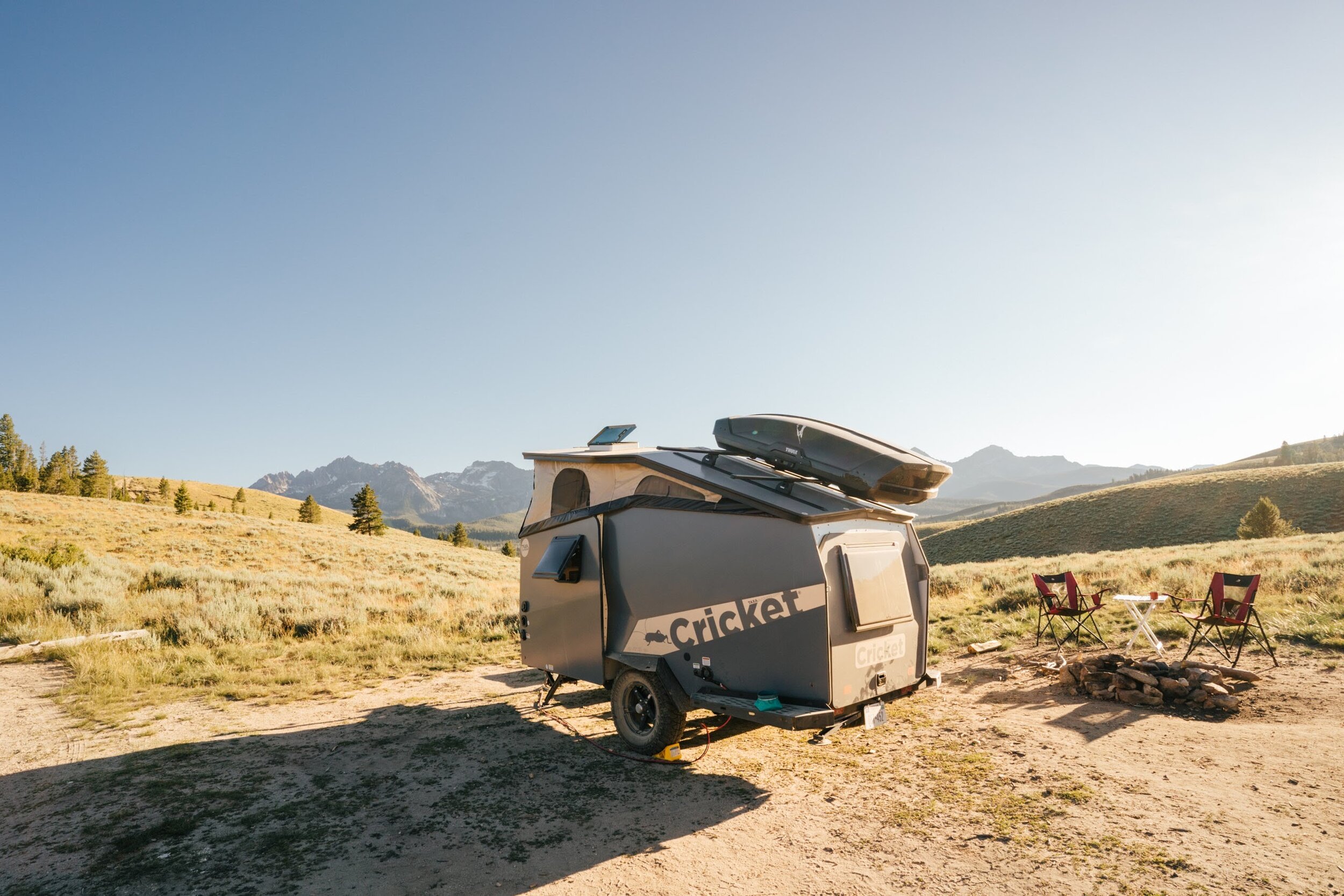
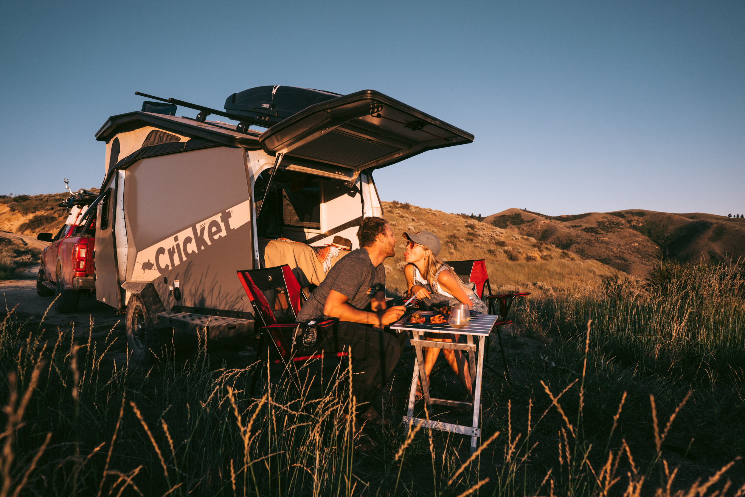
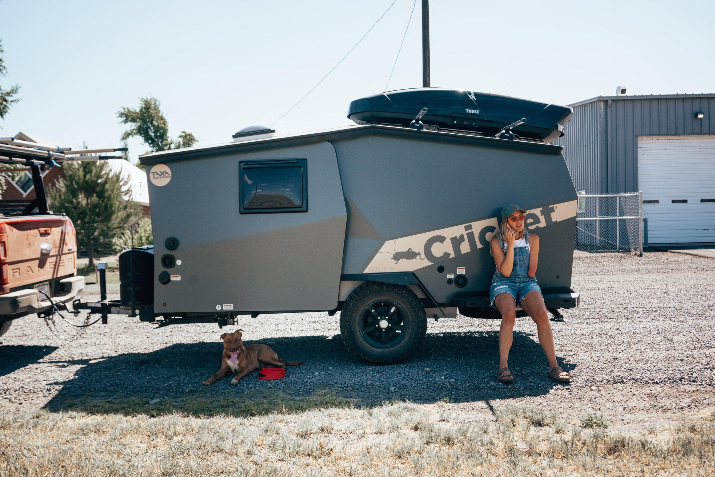
Cricket by TaxaOutdoors
Lightweight and rugged, Cricket is the perfect blend of sophisticated design and purpose that’s towable by many four-cylinder engines. With sleeping room for two adults and two children, TAXA’s NASA-inspired design features integrated plumbing and electrical systems to prepare you for excitement wherever the journey leads. Learn More.
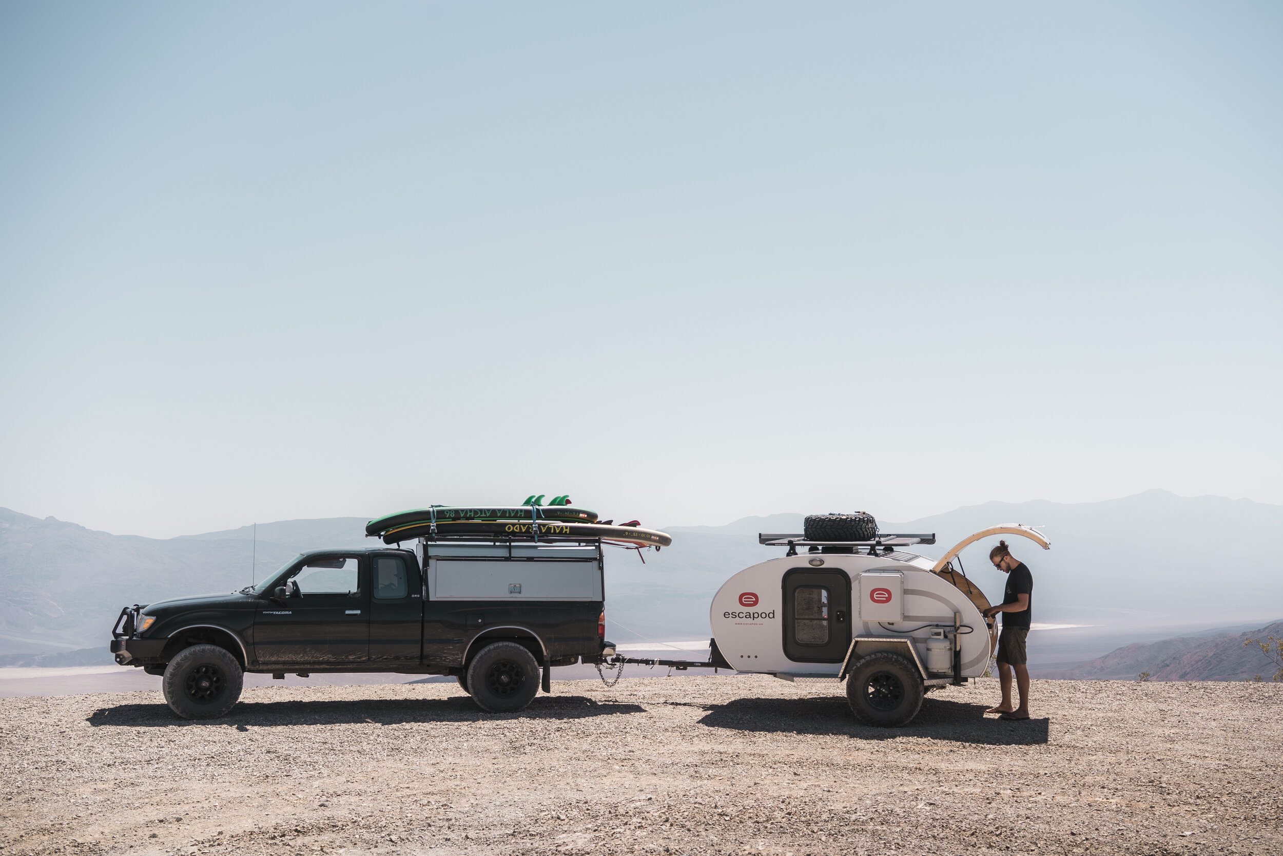
Escapod Trailers
Escapods (shown towards end of the post) are handcrafted teardrop trailers made right here in the USA. Bred for adventure and built for those who yearn to escape the beaten path. The Topo Series teardrop trailer comes ready to roll with upgraded suspension for the earth’s most technical terrain. Learn More.
5. STANLEY, ID
South-central Idaho and the jagged Sawtooth Range are SO captivating that we’ve driven this route a couple of times. We started with a short stint from Carbondale to Dinosaur National Monument, where we camped. Early the next morning, we drove north through the Flaming Gorge National Recreation Area; west through Ogden, UT; and north through Twin Falls, ID. Twenty-seven miles further is the start of the Sawtooth Scenic Byway, which stretches from Shoshone to Stanley. The prized portion of road features marvellous mountain views along State Highway 75.
By midafternoon, we reached the ethereal, wide-stretched Wood River Valley, which is home to Bellevue, Hailey, Ketchum, and Sun Valley. The lattermost town—population 1,473—is a recreation hub that’s famous for establishing the first ski chairlift in the world! Sun Valley is a great spot to grab lunch. We continued our drive from Sun Valley to Stanley, a one-hour heart-stirring journey through the Sawtooth National Forest. Along the way, you’ll ascend a winding mountain pass to Galena Summit Overlook at 8,701 feet high. You’ll need to pull over, as the sweeping views of the Sawtooth Valley and Sawtooth Range are too refreshing and awe-inspiring to not. At that high point, you’re surrounded by protected land: to the east is the Hemingway-Boulders Wilderness and to the west is the Sawtooth Wilderness. It sure does feel like you’re venturing deeper into the wild.
We descended and drove into Stanley, a charming town and gateway to the Main Salmon and Middle Fork of the Salmon Rivers. The community caters to anglers and whitewater rafters. If you’re interested in tossing a line or adventuring on water through one of the most remote wilderness areas in the Lower 48, there are plenty of guides!
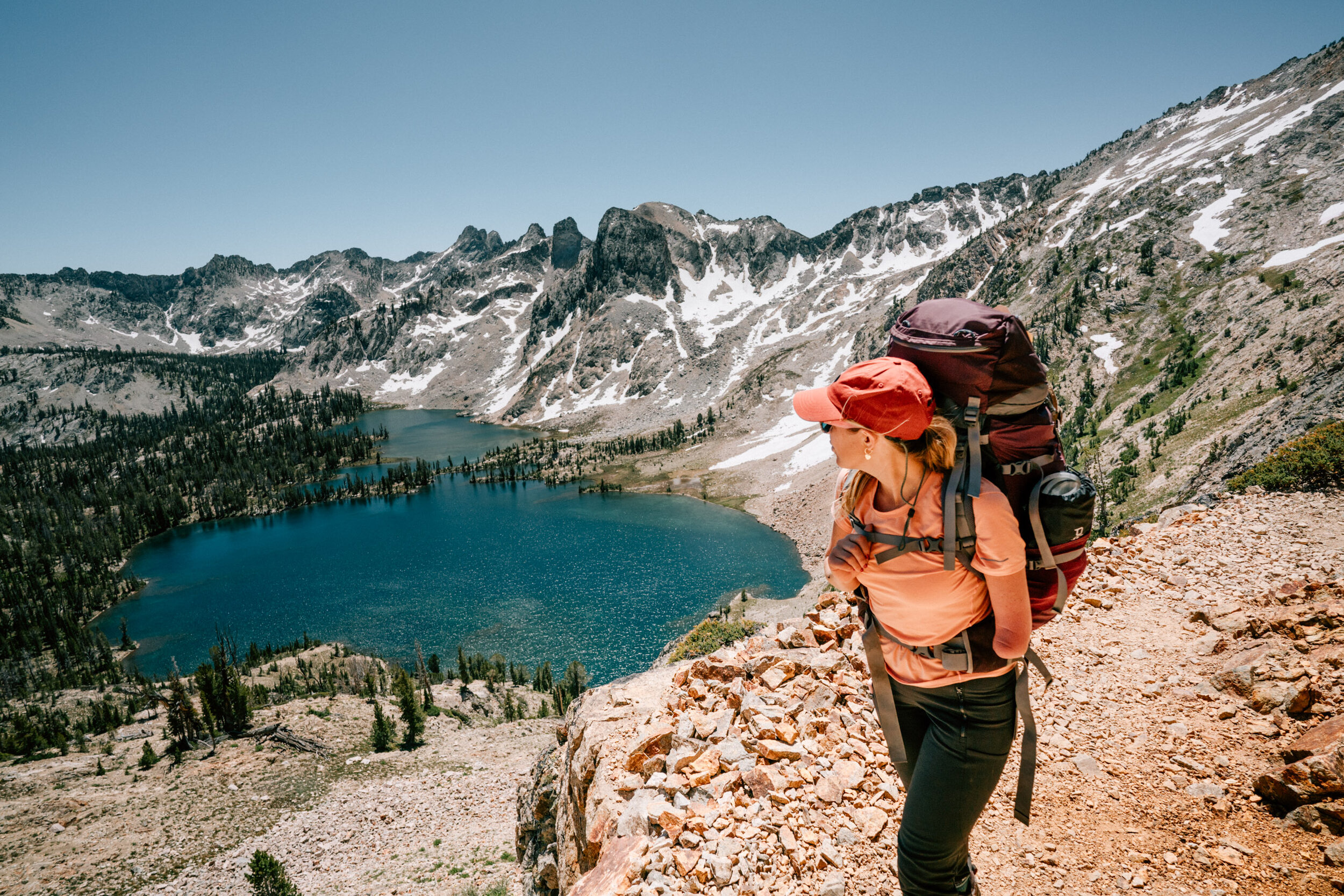
On both of our trips, we backpacked into the extraordinary, spine-tingling Sawtooths. Turquoise and crystal blue high-alpine lakes pool in basins below extreme granite formations that spike out of the ground. In every direction, the mountains are dramatic and massive. We trekked Goat Lake, an 8-mile out-and-back trail with nearly 1,800 feet of ascent. The other backpacking trip was a 21.3-mile loop with close to 4K feet of climbing: the Alice, Twin, and Edith Lake Loop.
Also, Idaho has at least 130 natural hot springs, which is the highest concentration in the country. More than 20 soak spots are in the Stanley area alone! Hot springs therapy is definitely on my list for our next road trip there.
Post backpacking, we drove east to West Yellowstone, MT, where we stayed the night in a hotel. West Yellowstone is an entrance to Yellowstone National Park, which is famous for the Old Faithful geyser, and there are close to 500 geysers in the entire park.
The next day, we drove through Yellowstone, out the park’s south entrance, and past Jackson Lake via US-91. The road threads Jackson Hole valley and Grand Teton National Park with unobstructed views of the shark-tooth Teton Range. Holy cow, there are some amazing campsites tucked into that area, where I’d love to stay overnight in the future. That road spits you out in the town of Jackson, which we passed through and headed south to Carbondale.
Distance: 1,608 miles
Drive time: 28 hours
Trip duration: 7 days
Lodging: United States Forest Service (USFS) campsites and a hotel in West Yellowstone
4. TAOS & SANTA FE, NM
This winter excursion took us to the radical ski lines and rich culture of northern New Mexico, known as the Land of Enchantment. Stop one was Taos Ski Valley, an independently owned ski area with extreme slopes and a mom-and-pop ambiance. The resort feels really extensive yet intimate and simple to navigate. There are 14 chairlifts total, including a gondola, and two primary lifts stretch up from the base area. I highly recommend that you ski here—but only if you have experience! It’s not really a beginner-friendly mountain. Dylan loved the glades, thrilling runs accessed by the 12,450-foot Kachina Chair Lift, and the hike-to terrain from the top of Lift 2. For me, the steep intermediate and expert runs were the best! The base area has a handful of charismatic taverns and restaurants, like the deck at Hotel St. Bernard, for après.
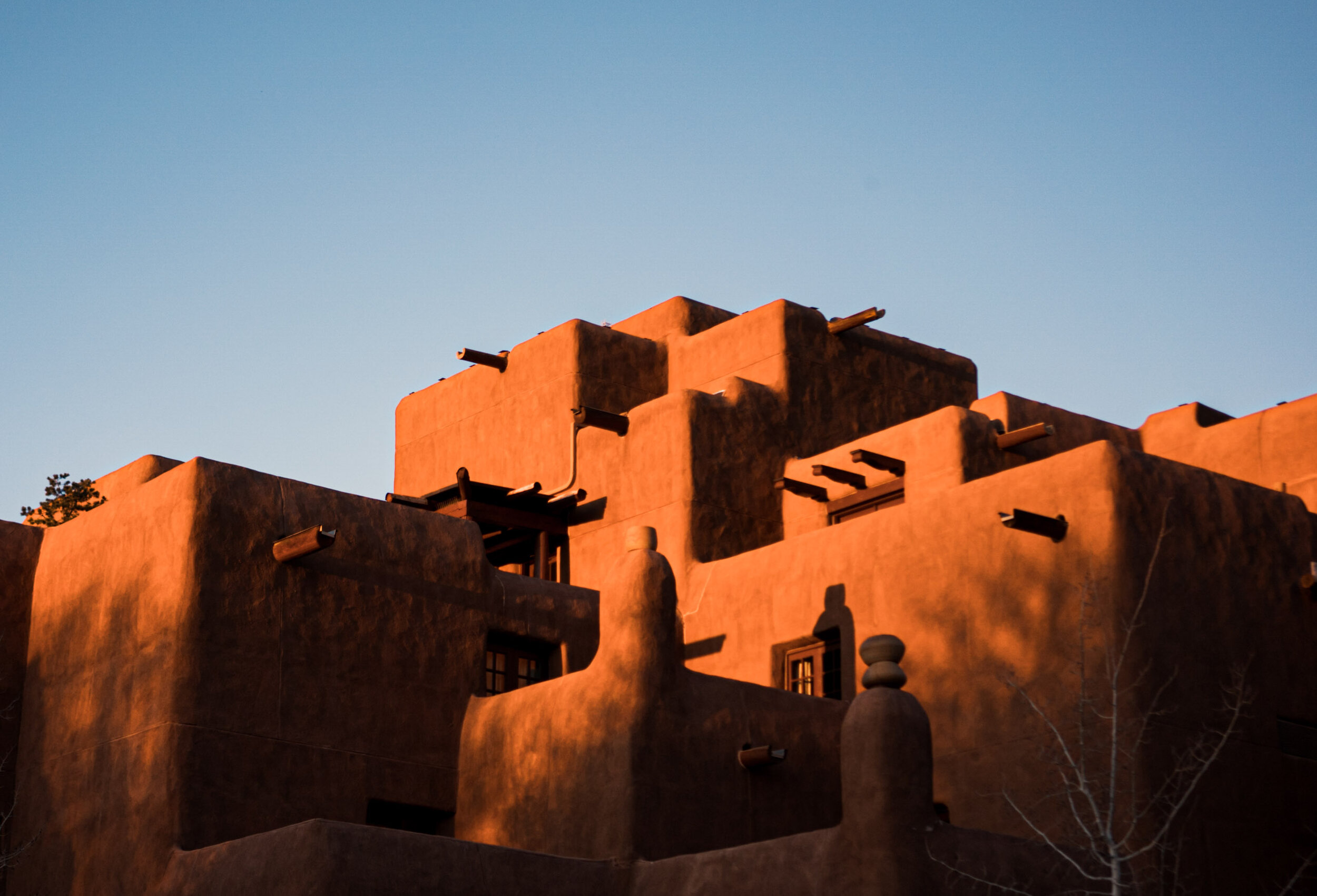
We stayed overnight in Taos, about 30 minutes away from the ski area. The town is flowing with creativity. There are countless galleries, art studios, workshops, and artist residencies. Multitoned adobe structures line the streets, which reflect this ancient community’s preserved, raw heritage. A few miles northeast of town is the Taos Pueblo, the area’s original indigenous settlement, which is more than 1,000 years old and still occupied today. A pueblo is a multistoried communal dwelling. Today, only 19 pueblos still stand in New Mexico, and each one still has its own government.
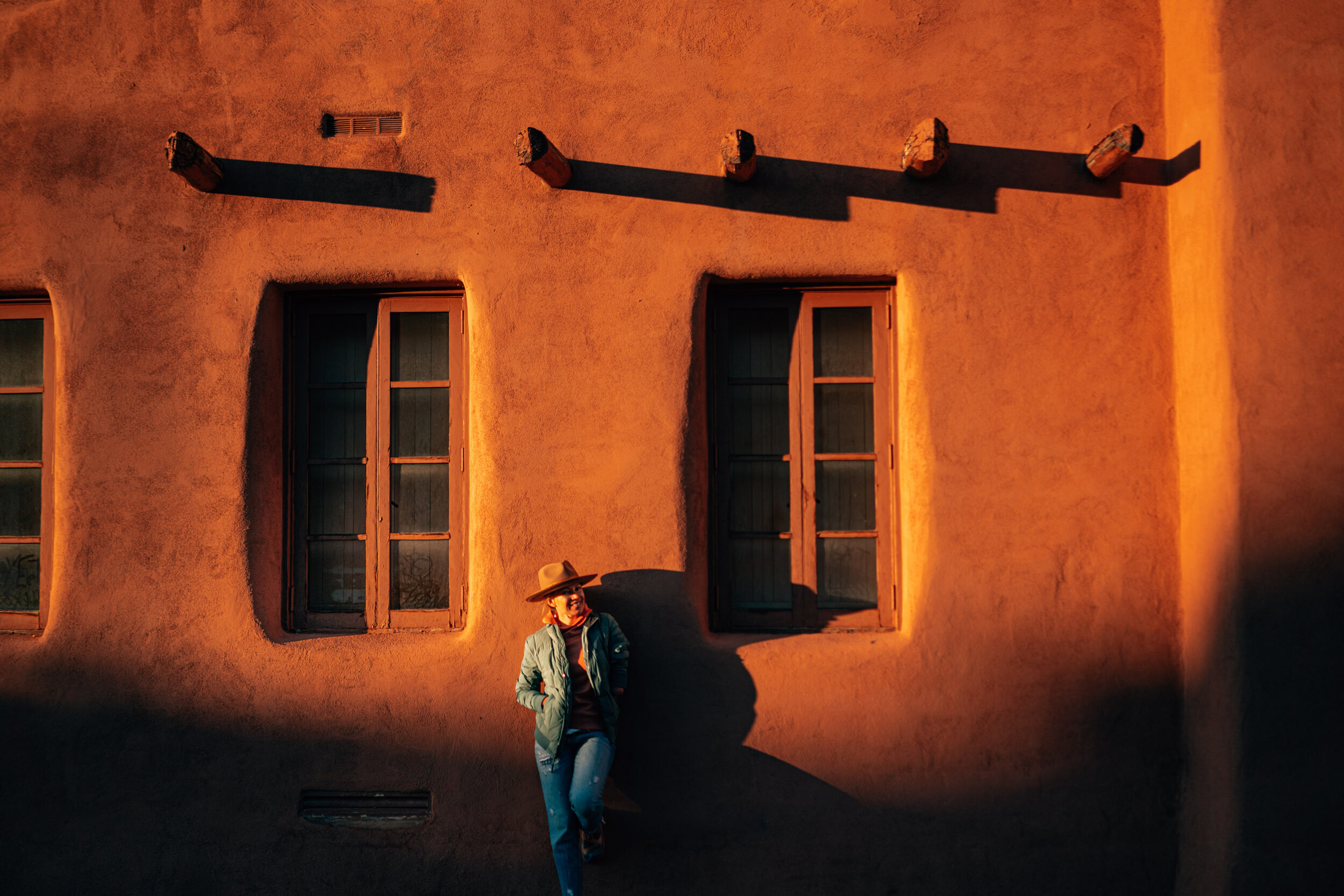
After we enjoyed a few ski days, we drove down to Santa Fe, another epicenter of traditional adobe designs and artistry of the Ancient Puebloans. The area was colonized by the Spanish, which is reflected in the unique architecture. A stark contrast exists between the walls of dried earth bricks and multiple Gothic-style chapels, including downtown’s towering Cathedral Basilica of St. Francis of Assisi, built in 1887. The cathedral is adjacent to the Santa Fe Plaza, which has been the city’s central gathering place for 400 years. Galleries, great restaurants, and a hip vibe fill downtown.
I love this one-of-a-kind city!
From Taos to Santa Fe, you’re inundated with art. New Mexico’s sky and sunsets are so painterly and beautiful. Georgia O’Keeffe spent time painting in Taos and throughout the state. With an art background, I felt like each town was a bright canvas and I left with so much inspiration.
Also, the next time we go, the trendy mud baths and hot pools at Ojo Caliente Mineral Springs Resort and Spa are on my list, as well as spending an overnight in Buena Vista, CO.
Distance: 800 miles
Drive time: 15 hours
Trip duration: 6 days
Lodging: Airbnb rentals in Taos and Santa Fe
3. SAN JUAN MOUNTAINS, CO
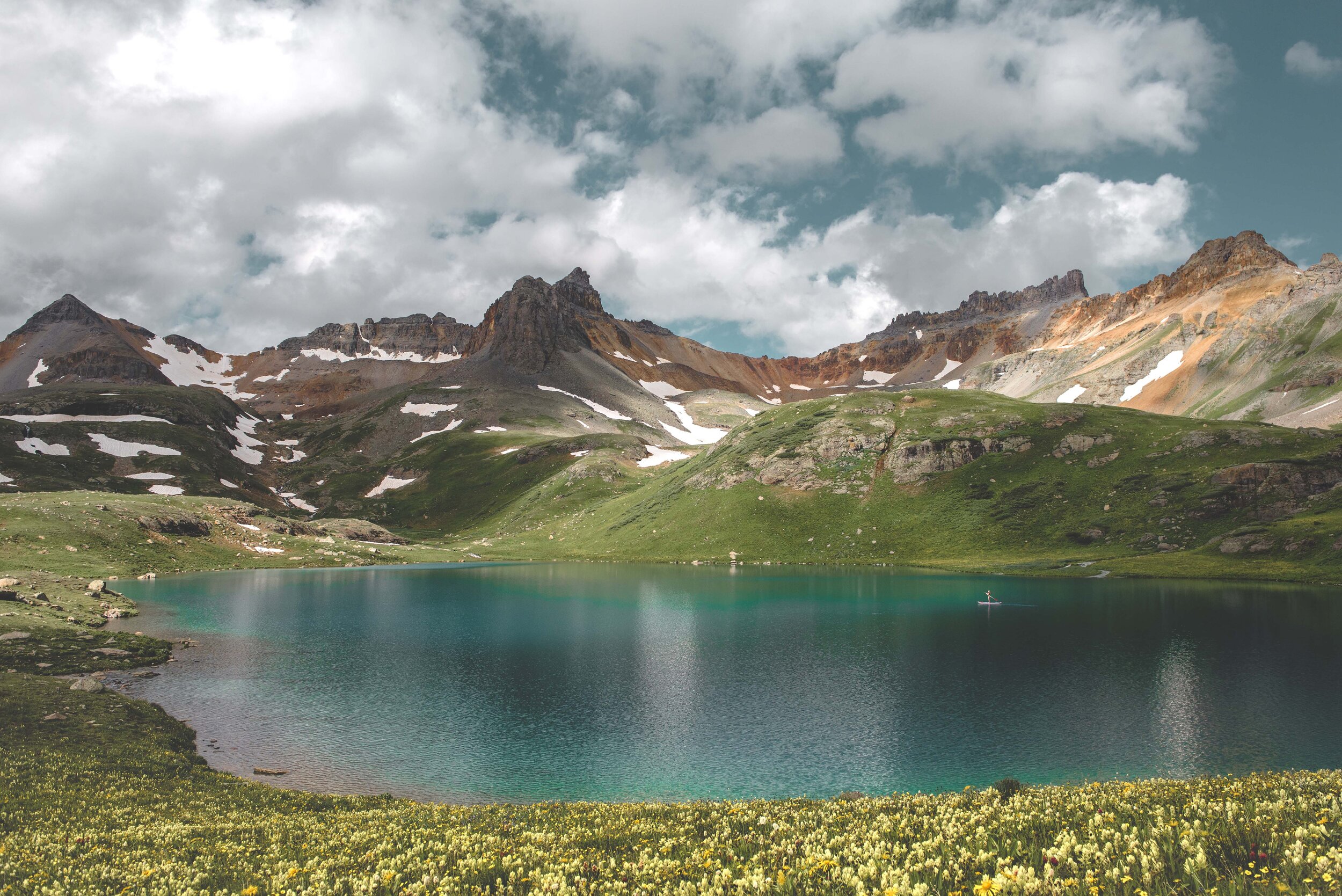
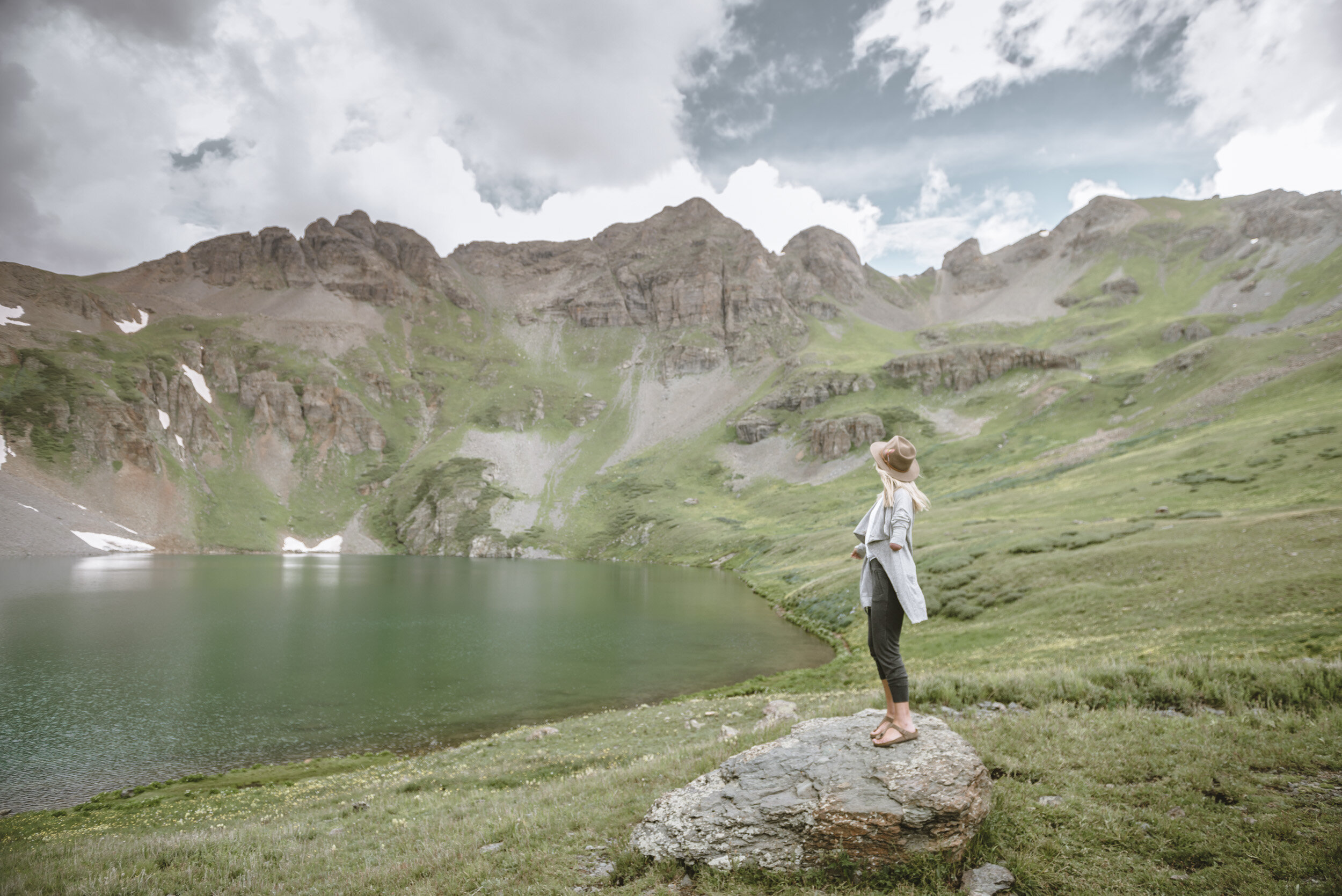
This lasso route through the heart of Colorado’s San Juan Mountains–also known as Switzerland of America–will take your breath away. This cluster of high-reaching mountains is imposing and truly incredible. A rainbow of green, red, yellow, and orange tones coat the rock features and reflect the area’s mining history. The high-elevation alpine lakes are so turquoise and transparent that they’re surreal.
As you approach Ridgeway, the stunning San Juans pierce the sky. You’ll continue into Ouray, where the box canyon narrows and the vertical cliffs become a citadel above and around you. It feels otherworldly and intimidating at the same time! Then, the challenging drive from Ouray to Silverton takes you over Red Mountain Pass, also known as the Million Dollar Highway, which is the inspiration of the area’s nickname, Switzerland of America. There are nearly no guardrails and perilous, sheer drops. So, drive responsibly and stop at designated pull-offs if you want to soak up the views! After you reach Silverton, a historic mining town with western storefronts and non-paved roads, you’ll continue this absolutely epic drive over Molas and Coal Bank Passes to reach Durango.
After you enjoy Durango for a night, you’ll drive back north to Telluride byway of Lizard Head Pass, which takes you by the cute mountain hamlet of Rico and glorious Trout Lake. Right before you descend toward the Telluride Valley Floor, the iconic 14,023-foot Wilson Peak, Mt. Wilson, and El Diente will fill the view to the west. The sight made my heart stop!
When we arrived in Telluride, I was enchanted by the idyllic town’s Wild West roots and rugged, skyscraping peaks. At the end of town, you can see Ingram Falls. But if you continue up the canyon and around a slight curve, you’ll see the state’s tallest free-falling waterfall: Bridal Veil Falls, which has a hydroelectric power plant at its top (it looks like a house). You can hike on the rocky switchbacks to the bottom of the falls. And, you can continue hiking higher to the top of the waterfall, too—which is well worth one of the most stunning views in the canyon, looking back toward Telluride.
When you drive from Telluride back to Ridgeway, one of the most memorable parts of the drive is on Dallas Divide mountain pass when the prominent Sneffels Range and Mount Sneffels break into view to the south.
For a thrill, you can take a heart-stopping jeep tour ride over Black Bear Road, which continues above Bridal Veil Falls and goes over to U.S. 550, between Silverton and Ouray. You can also challenge yourself with hiking one of the area’s 14,000-foot peaks. BUT I don’t recommend hiking to any of those challenging summits if you don’t have experience with long mileage on foot, high altitude, or scrambling.
Seeing this entire territory of Colorado was a true adventure full of beautiful shades and a shocking scale that invoked a childlike wonder and sense of awe for me!
Distance: 496 miles
Drive time: 11 hours
Trip duration: 5 days
Lodging: Airbnb rentals in Telluride, Durango, and Ridgeway. USFS camping around Silverton
2. SIERRA NEVADAS, CA
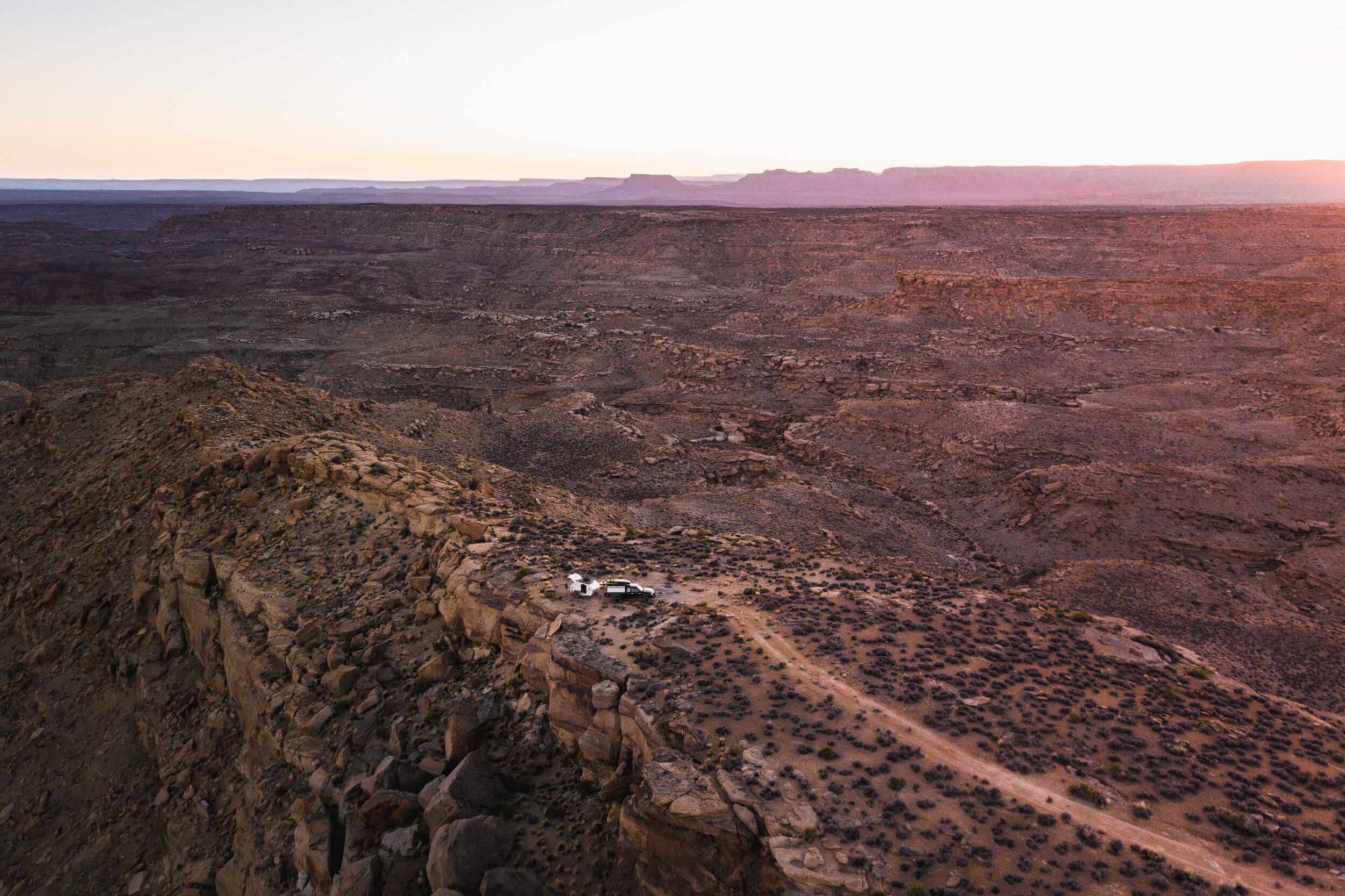
On this spectacular rendezvous, we made a loop through Utah and California with the ultimate goal of threading the magnificent Sierra Nevadas, one of my favorite mountain ranges on the planet. To start, we stopped in Escalante, UT, and then visited the North Rim of Grand Canyon National Park, in Arizona. From there, we checked out Death Valley National Park, in Eastern California. Death Valley lies adjacent to the Mojave Desert and is the lowest, hottest, driest place in North America.
But to the west is the reprieve of the Eastern Sierras. The arid slopes are speckled with sagebrush, junipers and chaparral. As the elevation climbs, the slopes are full of Douglas fir, pines, and giant sequoias, the largest trees in the world. (THE largest tree on the planet is in Sequoia & Kings Canyon National Parks. Named General Sherman, the voluminous tree is 2,000 years old! It’s on my list for next time.) The Sierra Nevada’s highest-reaching peaks—from 11,000 to 14,000 feet—fill this segment including 14,494-foot Mount Whitney, the tallest point.
We paralleled the range up to the town of June Lake, where we stayed overnight at one of my most memorable camp spots next to Reversed Creek. (Read more about that campground in my blog, “Camping for Beginner and Where to Go.”) There, we took a break from steering the rig and backpacked Thousand Island Lake, an 18-mile out-and-back trail that climbs nearly 4,000 feet to a high-altitude gem surrounded by a ragged granite skyline. Thousands of alpine glacial lakes decorate the Sierra Nevadas, which are punctuated by gigantic glacial-carved cirques. It’s one of the most jaw-dropping places I’ve ever been.
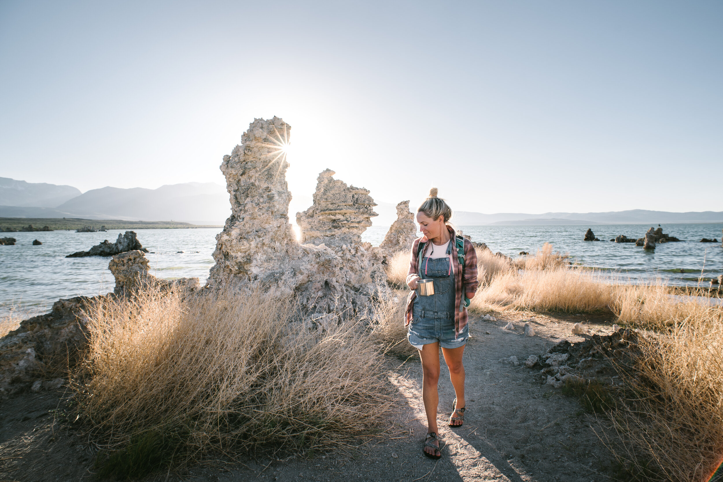
After our overnighter in the wild, we rested up with a night of camping then drove to Yosemite National Park—my favorite national park in the country—followed by Mono Lake. On the way home, we traced a network of backroads across Nevada and took a layover in Park City, UT. At that point, we felt tired, so we stopped at Flaming Gorge National Recreation Area and jetted back to Carbondale! That’s the beauty about road tripping after all—you literally hold the keys and can adapt your itinerary according to what you need.
On this adventure, I loved that we pulled an Escapod teardrop trailer behind the truck. We carried the comforts of home on the road, and we could sleep out of that trailer more comfortable than in a tent. Overall, it was awesome to spend such a saturated amount of time in Yosemite and the Sierras.
Distance: 2,139 miles
Drive time: 36 hours
Trip duration: 21 days
Lodging: Car camping at National Park Service (NPS), Bureau of Land Management (BLM), and USFS campsites. We stayed at a hotel in Park City
1. THE SOUTHWEST
My all-time favorite road trip was a balloon route circumnavigating the Four Corners region. We left from Carbondale with a pop-up Wildernest Camper on Dylan’s truck. Our first stop was Moab, UT. Then, we drove south and back into Colorado to explore Mesa Verde National Park. We continued through Shiprock, NM, on our way to Arizona, where we visited Canyon de Chelly National Monument and Lake Powell, at Glen Canyon National Recreation Area. We curved back into Utah and hiked in Bryce Canyon National Park. Our final stop was Escalante, UT.
At the time, I’d never explored the Southwest. I became completely enamored with the impressive rock features, breathtaking terrain, and history. I had this cosmic feeling in Moab that I’d lived there in a past life. The ancient ruins of Mesa Verde, timeworn canyons and buttes, and Bryce’s hoodoos highly activate your imagination. Mesa Verde’s archeological sites were constructed and inhabited by the Ancestral Puebloans in 550 A.D.! I found myself considering what it would have been like to occupy those places centuries ago.
Distance: 1,200 miles
Drive time: 20 hours
Trip duration: 14 days
Lodging: Car camping at NPS and BLM campsites

Comments +