


Co-written by Sarah Herron and Morgan Tilton
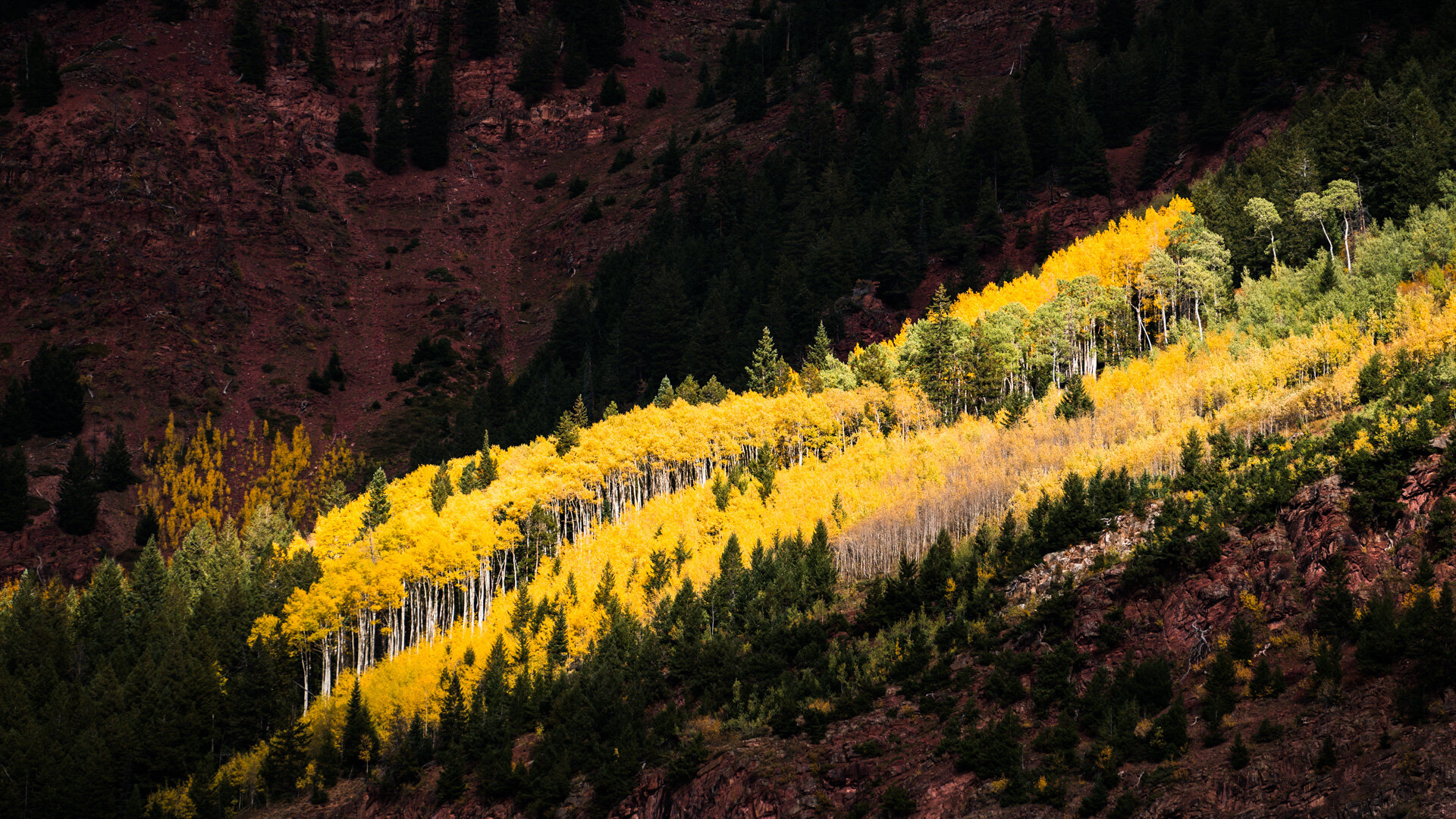
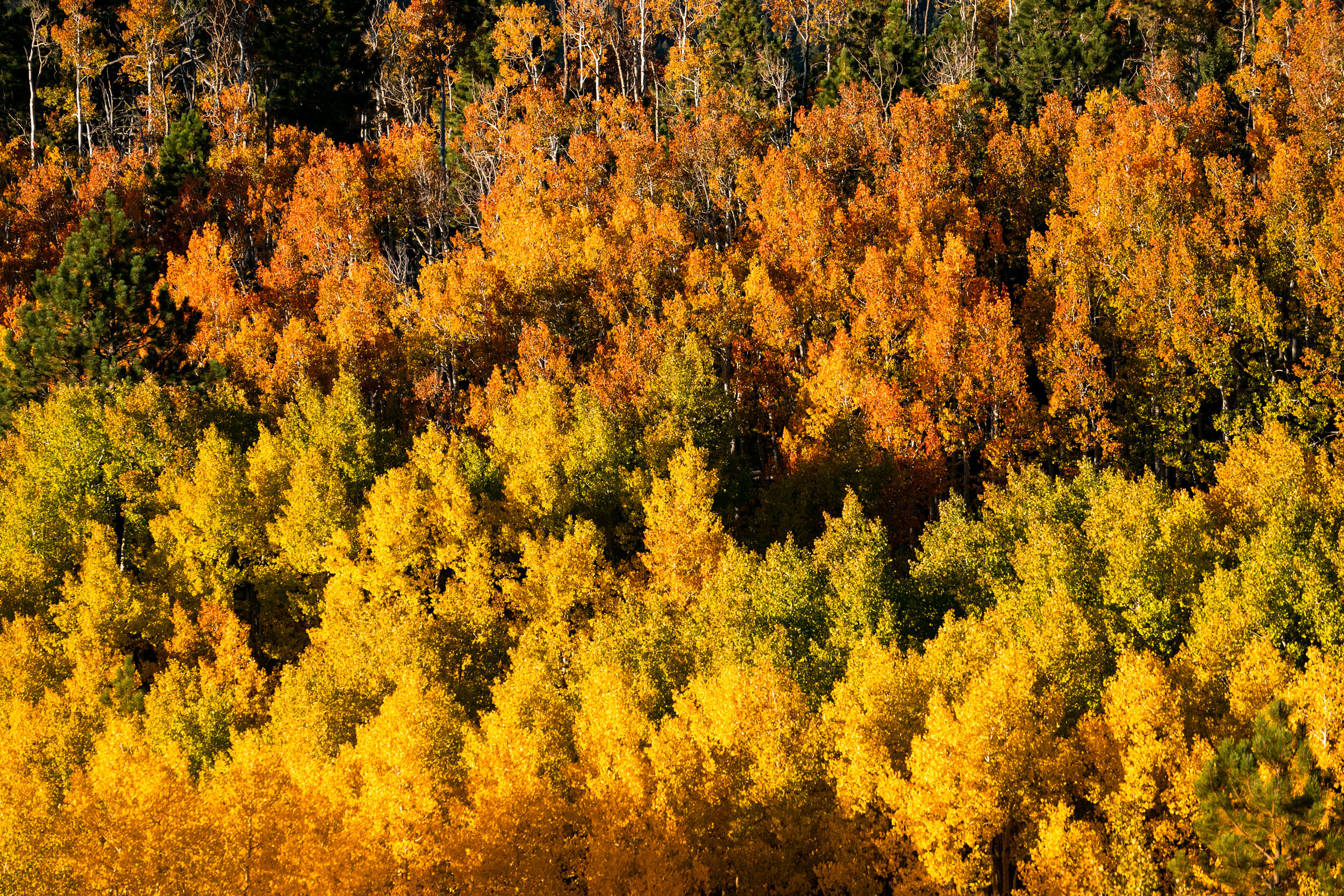
Beyond high-altitude peaks and endless ski runs, the Centennial State gloriously shimmers with fall colors each year, as the temperatures start to drop. From September to October, patches of overwhelmingly brilliant aspen groves, cottonwoods, and various shrubs blanket the landscape below granite summits. Gold, yellow, orange and maroon shades paint the mountainsides, punctuated by alpine lakes, which mirror the fleeting tones. The fall season is one of my favorite times to venture out and enjoy the ephemeral beauty of Colorado’s forests.
Here are my top six areas to enjoy the fall foliage each year. Don’t wait to go—in true Colorado fashion, a blizzard could hit any day! With luck, though, you’ll witness a dusting of snow as a backdrop to lemon and amber leaves—it’s such a precious sight.
6. McClure and Kebler Passes
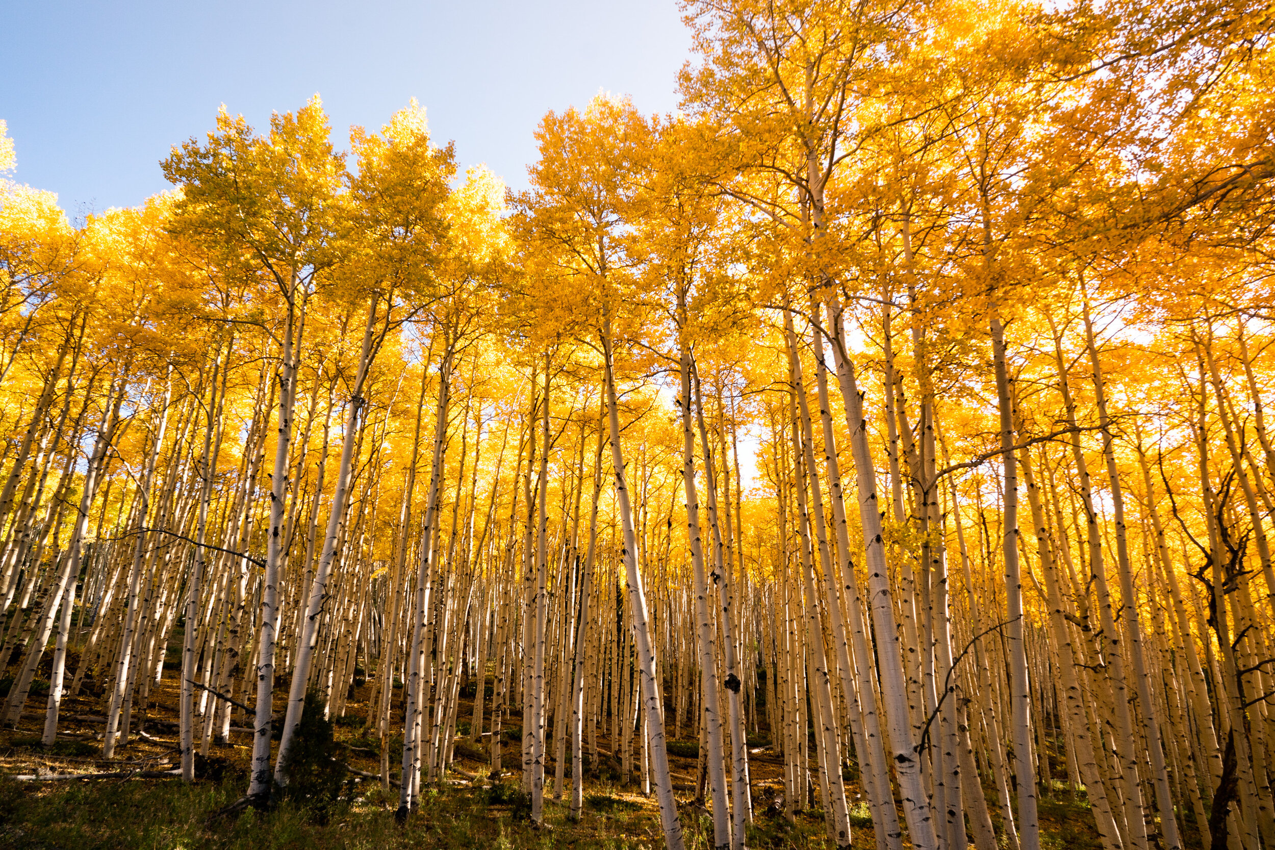
One of my favorite places to see the leaves change is along the Crystal River, as you drive from Carbondale to Marble via CO-133 and Rd 3. This winding canyon is full of aspen groves and the Crystal is a radiant, transparent cyan—like the color of Listerine cool mint mouthwash! The drive is about 45 min from Carbondale to Marble. When you arrive, you pass by a humongous patch of dancing aspens. A heavenly BBQ restaurant, called Slow Groovin, is right in town—their menu is reason enough for out-of-towners to trek to this tiny town.
Marble—population 144—is quaint, charming, and has a unique history compared to other Colorado high-alpine communities. In the 1870s, geologist Sylvester Richardson and prospector George Yule discovered marble in The Crystal River Valley. A thick marble artery is present in Treasure Mountain, so the town focused on quarrying rather than developing their mining. In turn, they avoided the silver and gold bust that led to so many Colorado ghost towns. Today, the marble is still quarried and has been used to create several national and state landmarks including the Lincoln Memorial. Though, I have to admit, all of the marble ornamentation is slightly eerie—or at least, super quirky! Statues and headstones are scattered throughout the streets and in front yards.
Beaver Lake, one of my favorite lakes for stand-up paddleboarding, is on the east end of town. If you’re brave enough to paddle atop the chilly water in October, you can float while enjoying epic scenery with Mt Daly to the north and Whitehouse Mountain to the south. After you enjoy Marble, continue your journey over McClure Pass, which reaches a high point of 8,770 feet high. Then go southeast on Kebler Pass (Gunnison County Road 12), which is the largest aspen grove in Colorado. Kebler Pass threads the dynamic terrain between Marcellina Mountain, West Beckwith Peak, East Beckwith Mountain, the Anthracite Range and Ruby Range—except, the foreground of these exquisite formations is full of towering aspens! The meandering road ends in the historic mining and ski town of Crested Butte, so you can also make an overnight trip or weekend getaway out of the scenic foliage drive.
Start: Carbondale or Crested Butte
Distance: 168 miles round-trip
Drive time: 6 hours, 18 min
Land Management: White River National Forest, Lincoln National Forest, Grand Mesa Uncompahgre and Gunnison National Forests
Campgrounds: Redstone, Bogan Flats, Erickson Springs, Lost Lake Campground-Paonia Rd
When to Go: Late September
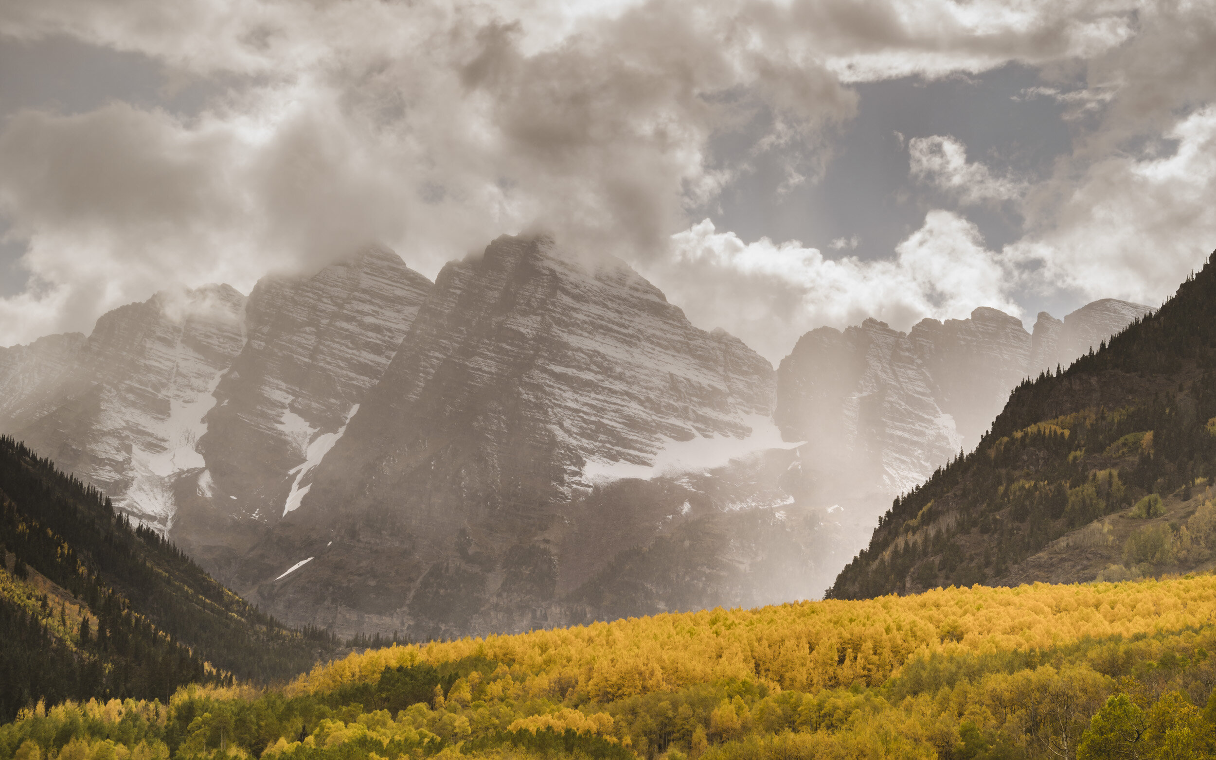
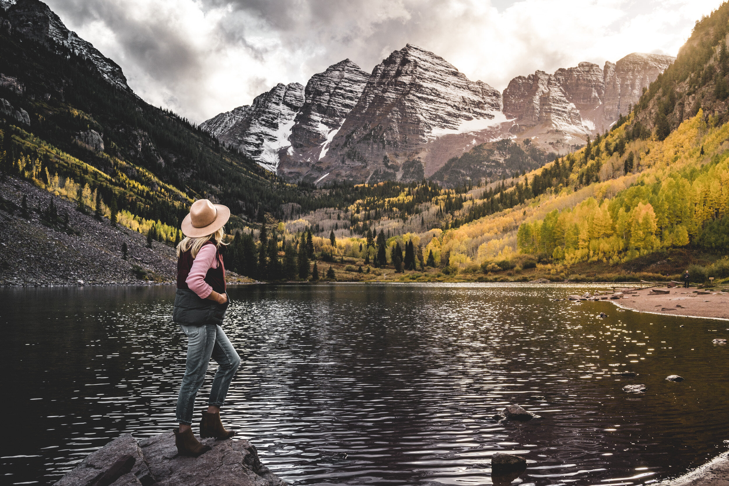
5. Ashcroft Ghost Town and the Maroon Bells
Viewing the iconic Maroon Bells and Ashcroft Ghost Town are each magnificent year-round—but particularly as the colors change in the Elk Mountains. These two destinations are accessed by separate mountain valley roads that extend south of the town of Aspen. Each route is home to thick, expansive aspens that make you feel so tiny. As you can stand in the middle of the groves, you see nothing but golden light all around you. In Ashcroft, the silhouette of Star Peak stands out to the south. At Maroon Lake, you can blissfully soak up that quintessential reflection of the Maroon Bells.
From Aspen, drive along Castle Creek Road to reach Ashcroft and on Maroon Creek Road to reach Maroon Lake Trailhead. Neither road is extremely time-intensive to navigate, so you can explore them back-to-back and in either order. When you arrive at Maroon Lake Trailhead, walk a few paces from the parking lot. Within a minute, you’ll have breathtaking views of Maroon Lake, which rests below Maroon Peak and North Maroon Peak: the Bells, which are nicknamed for their bell-like shape and red shale tone.
Start: Aspen
Distance: 44 miles total
Drive time: 1 hour, 34 min
Land Management: White River National Forest
Campgrounds: Silver Bar, Silver Bell, Silver Queen
When to Go: Late September to beginning of October
4. U.S. Route 285
The drive along U.S. Route 285 from Denver to Buena Vista is non-stop color! I once took this drive to a friend’s wedding in Buena Vista, mid-September, and the leaves were going off. The couple got married on a private ranch encircled by multicolored aspens—I can’t think of a better venue to tie the knot!
Thirty minutes outside of Denver, this highway takes you through Conifer followed by the access point of Guanella Pass Scenic Byway and over the top of Kenosha Pass, both of which offer endless options for hikes in the heart of stunning aspens. After you descend Kenosha, you continue into Fairplay. Once you reach Buena Vista, you’re you’re at the foot of Central Colorado’s Sawatch Range including a row of 14,000-foot peaks (also known as 14ers), several of which are called the Collegiate Peaks: Mount Princeton, Mount Yale, and Mount Harvard.
If you don’t have the time to go all the way to Buena Vista, head to Guanella or Kenosha Pass for a mellow walk through the woods or meadows. Or, if you’re eager for a bigger day on foot, hike up one of the area’s 14ers. If you do, be sure to check the route’s conditions, as these peaks can receive snowfall in autumn! Also, do your outbound drive pre-dawn—yes, at dark-thirty—for an alpine start, so that you can descend off the summit before noon to avoid lightning or other weather. When you head home, you can scope out the bright leaves in daylight!
Start: Denver
Distance: 246 miles round-trip
Drive time: 4 hours, 32 min
Land Management: Pike and San Isabel National Forests
Campgrounds: Timberline, Kenosha East, Kenosha Pass
When to Go: Early to late September
3. Independence Pass
Independence Pass not only boasts foliage but steep cliffs above the cascading Roaring Fork River. Hairpin turns. Amazing campgrounds. And sweeping views from atop the 12,095-foot high point. It all makes your heart stop! This exciting route is extremely popular for cyclists, as well as road trippers. Be aware: There are tight curves and single-lane segments, so don’t let the sights distract the driver!
While all of these developed campgrounds offer a fair amount of privacy, amenities, and a gorgeous environment, the Weller Campground—in the middle of aspens—is my favorite choice for a fall-season overnight. When possible, reserve your spot well in advance! This area is extremely popular for the camp crowd.
Start: Aspen or Leadville
Distance: 57 miles round-trip
Drive time: 3 hours, 14 min
Land Management: Pike and San Isabel National Forests, White River National Forest
Campgrounds: Difficult, Weller, Lincoln Gulch, Lost Man, Twin Peaks, Whitestar, Lakeview
When to Go: Mid-to-late September
2. Trail Ridge Road
Trail Ridge Road is deemed as a highway to the sky, and the claim is spot on. This 48-mile-long paved road weaves through Rocky Mountain National Park (RMNP) and reaches an altitude of 12,183 feet: the highest continuous paved road in the United States. This stretch connects the park’s eastern gateway of Estes Park to Grand Lake, on the park’s west boundary. The road ascends close to 4,000 feet, meaning, you have a chance to travel through aspen and ponderosa pine and then above those montane forests to alpine tundra for a bird’s eye view. In total, 11 miles of the journey are above treeline, where the forest comes to a halt at 11,500 feet.
Beyond the remarkable views, there are loads of great hiking trails in RMNP. If you drive Trail Ridge Road, plan on taking a stroll in the downtown area of Grand Lake, too. The wooden boardwalk, boutiques, and shoreline views are fun and so picturesque.
Start: Estes Park or Grand Lake
Distance: 94 miles round-trip
Drive time: 2 hours, 56 min
Land Management: Rocky Mountain National Park
Campgrounds: Aspenglen, Green Ridge (Lincoln National Forest), Cutthroat Bay Group (Arapaho & Roosevelt National Forests)
When to Go: Mid-September to mid-October
1. Lizard Head Pass
From start to finish, this mountainous drive is chock-full of rugged peaks and jaw-dropping hillsides that pop with patches of orange and yellow leaves. As you leave Dolores, CO-145 follows the Dolores River, where gigantic cottonwoods flank the water and are home to bald eagles, so keep your eyes peeled!
The road climbs to the small town of Rico before it winds to the top of Lizard Head Pass, where you can see the road’s namesake Lizard Head Peak—yes, the rock formation actually looks like a lizard’s head! As the pass begins to descend, Trout Lake appears to the southeast of the highway. The clear water sits below an amphitheater of spectacular peaks including San Miguel, Beattie, and Ulysses S. Grant. This lake is one of my favorite locations to stand-up paddleboard in Colorado! The drive has been blissful so far but the views ahead are among the best: as the highway approaches Ames, the slopes become steep. You can see views of rocky mountainsides and aspens across the deep ravine. After a sharp bend in the road, you’ll ascend until you reach an open meadow: to the west, you’ll see the skyline of Mt Wilson, Wilson Peak, and El Diente, three sharp 14,000 peaks.
To fuel up, you can grab a delicious pizza or brew at the Dolores River Brewery!
Start: Dolores or Telluride
Distance: 130 miles round-trip
Drive time: 2 hours, 40 min
Land Management: San Juan National Forest
Campgrounds: McPhee, House Creek, Cayton, Matterhorn, Sunshine
When to Go: Mid-to-late September
Comments +