


Co-written by Morgan Tilton, Adventure Journalist
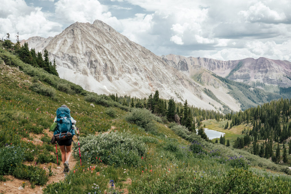
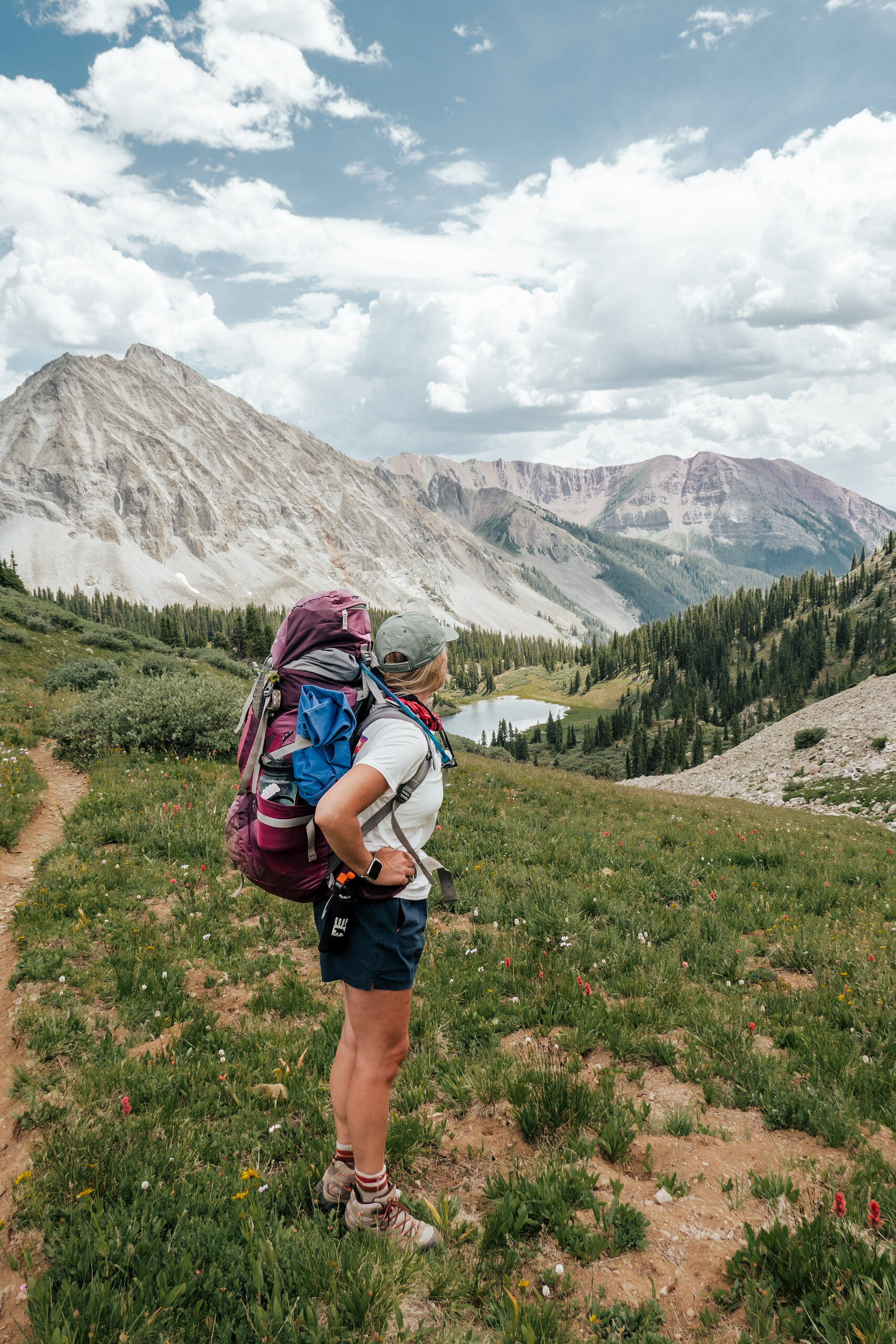
By far, one of my favorite hikes in the Elk Mountains is the hike from Aspen to Crested Butte—two of Colorado’s historic mining-turned-ski towns. The hike from Aspen to Crested Butte is one of the most popular hiker’s attractions during the summer months in these two mountain towns. But there’s a lot of confusion of how to tackle this adventure! In this post, I’ll cover everything you need to know how to hike from Aspen to Crested Butte and back. Last summer, we led a few women an overnight backpacking trip via East Maroon Pass, over the mountains that separate these two communities. The adventure was one of our earliest and most formative Tents Without Gents group trips.
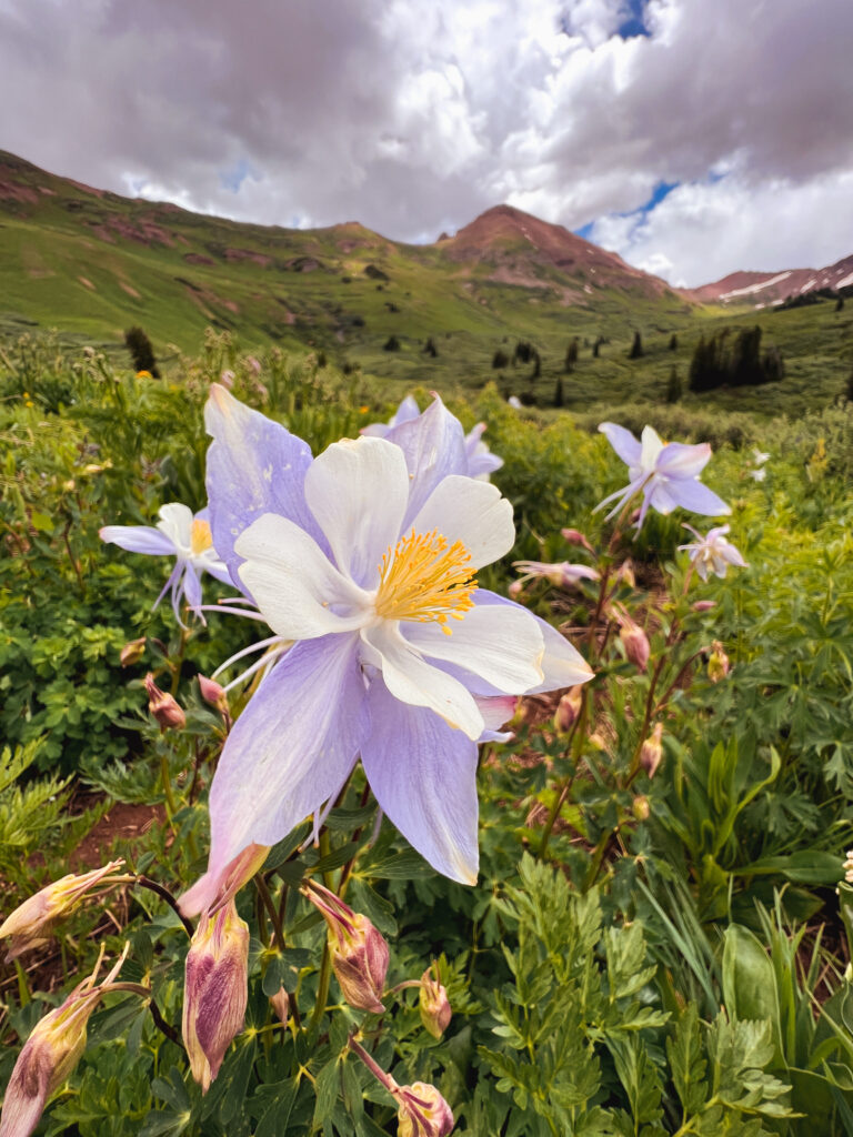
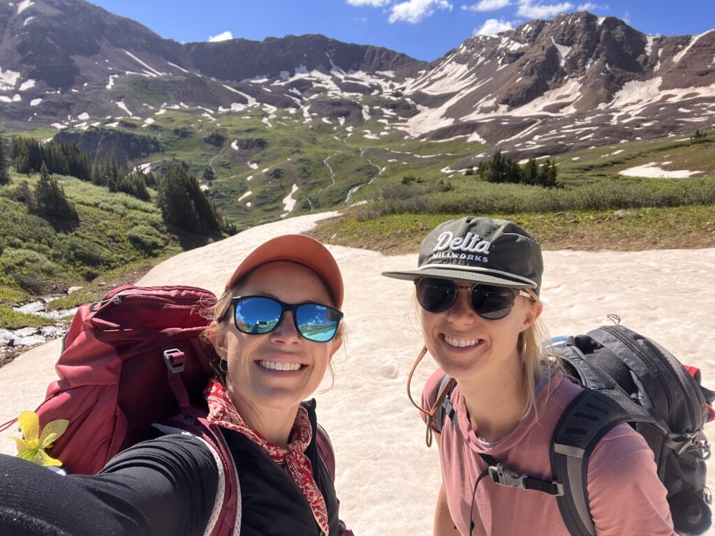
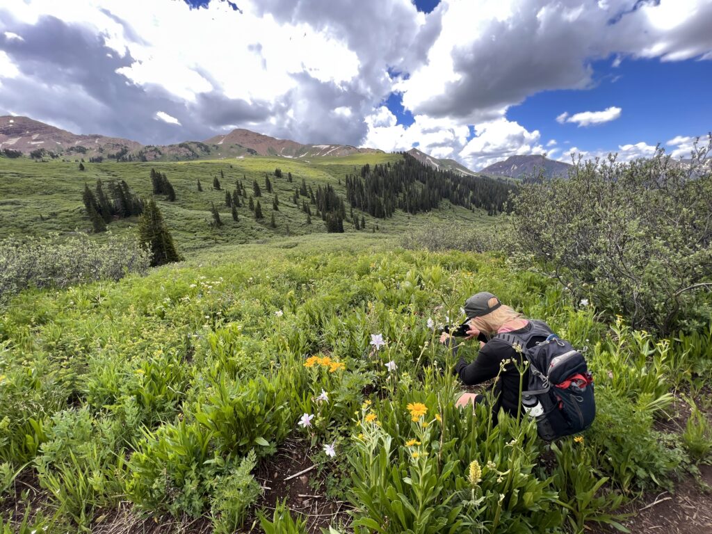
The views from the top of Maroon Pass are UNREAL. Bright yellow arrowleaf balsamroot and intense scarlet paintbrush filled the slopes, two of my favorite wildflowers. For many women, it was the furthest they’d ever hiked. We shared an immense feeling of accomplishment: It was amazing to use our own feet, hone our outdoor skills, and practice positivity while traversing these rugged peaks, from one local to another.
That was a 3-day backpacking trip—this blog post is an itinerary for a single-day excursion, not the backpacking route. The day hike route along West Maroon Pass, the most popular and shortest point-to-point iteration. From the brilliant blue glistening lakes to mesmerizing wildflowers, the trek is well worth the effort!
Here are the nitty-gritty details for this unparalleled hike from Aspen to Crested Butte, Colorado so that you can go, too.
Day Hike from Aspen to Crested Butte: West Maroon Pass Route
One of the trickiest ingredients of this point-to-point adventure—other than being prepared with the right gear and fitness—is organizing the drop-off and pick-up logistics in Aspen and Crested Butte. Plan ahead: You’ll need to book your shuttles well before your trip!
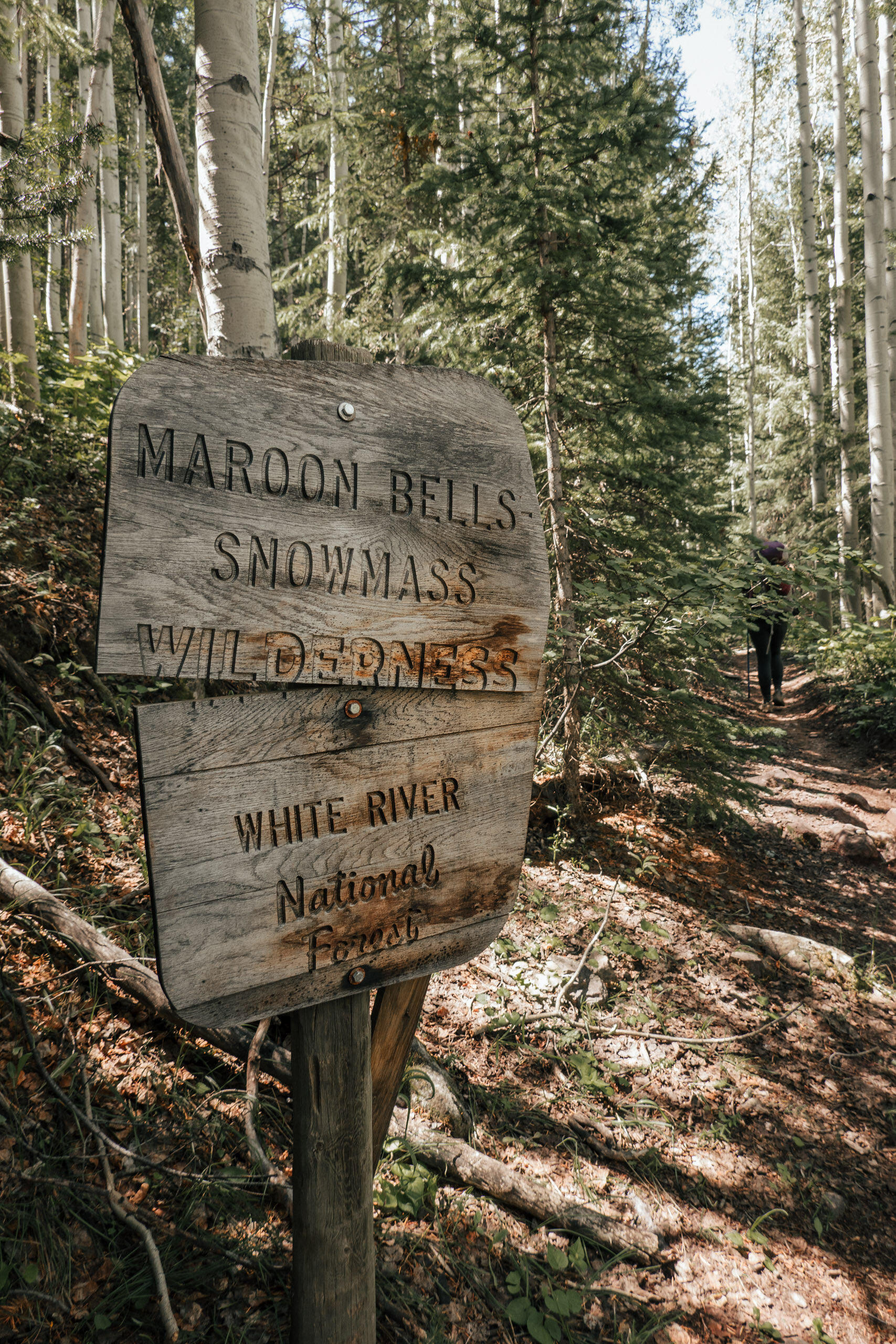
At the day’s end, we’re at the whim of Mother Nature as far as an official ‘open’ date for the backcountry. Contingent on winter’s snowfall and the spring weather conditions, the snow melts enough to clear the singletrack, as well as the access road to the trailhead on the Crested Butte side: Schofield Pass.
Schofield Pass typically reopens by July, so that’s a good bookend for this hike. The Schofield area is ethereal, majestic—and can be pretty dangerous. If you don’t reserve a professional shuttle, be sure that whoever picks you up is comfortable and experienced enough to drive this exposed, isolated route and has the appropriate vehicle for the job.
Season
July to October. July is when the wildflowers start to bloom. September is when the fall foliage pops.
Trailheads
Start at Maroon Lake Trailhead, 11 miles southwest of Aspen (otherwise known as the Maroon Bells Lake, located at the end of the road past Aspen Highlands Ski Resort). End at East Fork of West Maroon Trailhead, 15 miles north of Crested Butte.
Trail
West Maroon Trail #1970.
Map
This area is fairly well-trafficked and documented online, but it’s always a good idea to carry a physical map, even as a backup to a digital track. The Maroon Bells, Redstone, Marble National Geographic map has the trails for this venture.
Mileage & Elevation
The West Maroon Pass route is 11.45 miles one-way with 2,250 feet of ascent.
Weather & Timeframe
Save your snooze button! Due to consistent afternoon thunderstorms that roll through the range—lightning included—it’s safer to leave early in the morning. Ideally, aim to start hiking from Maroon Lake Trailhead at 6 a.m., the earliest time that drop-offs are allowed. Hikers should ascend and descend West Maroon Pass by noon.
Regardless of your itinerary, be sure to check the weather the day before and morning of departure. Fingers crossed for blue skies!
On average, this route takes 6-8 hours to hike, give or take. I always opt for the generous time estimate: I love taking my time to identify flowers, capture photos, and enjoy a picnic lunch along the way!
Altitude
Hikers reach a 12,386-foot high point on West Maroon Pass.
Permit
None required. Register at the trailhead.
Parking
Reservations are required for overnight parking ($10) at Maroon Lake Trailhead; arrive 6-8 a.m.; depart 60 hours later, by 6 p.m. Reservations open in April.
Private Drop-off
The easiest thing is to ask a friend for a favor and have them drop you off at the trail head before your departure. Offer to buy them coffee when you get back, because they must drop you off at the trailhead 6-8 a.m. The road is closed to public vehicles after 8am. No commercial drop-offs are permitted.
Shuttle Drop-Off
The drawback to reserving a shuttle for the drop-off is that you won’t be able to start this hike until 8:30 a.m., at best, which is bridging late for a long, high-altitude trek.
Reservations are required for a round-trip shuttle ticket from Aspen Highlands Village to Maroon Lake Trailhead ($16 for 13- to 64-year-olds). Arrive 45 minutes before your departure time, which start as early as 8 a.m. Reservations open in April. There’s a free RFTA shuttle from Aspen’s Rubey Park Transit Center to Aspen Highlands Village (6:20-2:00 a.m.; departing at :00, :20, and :40).
Arriving in CB / Shuttle Pick-Up
On the far end, you’ll need a shuttle or friend to swoop you from East Fork Trailhead. Dolly’s Mountain Shuttle offers pickups at the West and East Maroon Pass trailheads, or a full shuttle back to Aspen. *Note, the road from the main Schofield Pass Road Trailhead is CLOSED to the East Fork of West Maroon Trail Head (where you’ll come off the trail). This means you will need to walk an additional 1.5-2 miles down the dirt road to where cars can park. You’ll pass Emerald Lake, which is an added bonus! If you bring your furry pal, you’ll need to reserve an additional seat in the van for the pup. Alpine Express likewise offers pick-up (and drop-off) service—for West Maroon or East Maroon Pass routes—and can be booked for a full ride back to Aspen.
Another option is to book a one-way shuttle for your vehicle with Maroon Bells Shuttle, to meet you in Crested Butte at the finish.
If you plan to stay overnight at a hotel in Crested Butte or Mount Crested Butte, check with them regarding an in-house trailhead shuttle service, too.
Dogs
Fido is allowed as a leashed companion in the Maroon Bells-Snowmass Wilderness. In Gunnison National Forest (which you enter near the end), furry friends are required to be on a leash in crowded areas and campgrounds.
In addition to a leash, pack water and snacks for your four-legged companion! Dog paws can get torn on rugged terrain: consider packing a pair of dog boots like the Ruffwear Grip Trex Pair.
Absolutely bring pet waste bags—biodegradable ones, like this design made by Doggy Do Good—and a designated case, like the Doo Doo Tube, for transporting your dog’s waste out of the mountains. Human and dog waste alike contribute to bacteria entering waterways.
Gear List
Trekking Poles
Hiking poles are great for supporting my knees on the steep descent off West Maroon Pass. I use the LEKI Cressida Cor-Tec Trekking Poles, which are specifically made for women’s hands.
Hiking Boots
Sections of the trail are really rocky, so I prefer to wear boots with solid ankle support. The Danner Mountain 600 Hiking Boot is my all-time favorite boot for ladies!
Hiking Pack & Water Reservoir
I wouldn’t go smaller than a 30-liter pack for this day trip, because having enough space for extra layers is key. You’ll also need to carry your lunch, plenty of snacks, and an adequate amount of water. The Deuter Speed Lite SL Backpack is ergonomic, supportive, adjustable, and perfectly contours my hips and shoulders.
I prefer to use a hydration bladder over a water bottle, so that I can sip as I go. To help stave of dehydration, it’s important to consistently hydrate, especially in Colorado and at high altitude. My top choice is the Platypus Hoser Reservoir, which has a comfortable and soft HyFLO bite valve.
Hat
My friend Rachel Pohl, a widely-known painter, creates these beautiful hats! The one that I own has the paintbrush flowers, which I love, but it’s currently sold out. She has many great other designs.
Sunscreen
Sun protection is sexy. My favorite type right now is Supergoop Play SPF 30.
Electrolytes
As you exercise and sweat, you lose vital electrolytes that help regulate your body’s function, performance, and an ability to feel good. The primary minerals include sodium, potassium, and magnesium, according to the Cleveland Clinic. A variety of products exist now to help you replace your electrolytes on-the-go.
Liquid I.V. Hydration Multiplier is my favorite drink supplement, and it’s easy to carry on the trail. Be careful not to leave behind an micro-trash!
Rain Jacket
When rain hits the high mountains, the temperatures quickly drop. If you’re wet and cold, that’s a good recipe for hypothermia. Don’t leave on a long hike—or any hike, really—in Colorado’s mountains without a rain jacket. Thanks to the quality and fit, I always bring my Eddie Bauer BC Dura 3L Jacket.
Garmin InReach Mini
For emergency use, I carry the Garmin InReach Mini, which is compact and allows two-way messaging, as well as GPS tracking and weather updates.
Peak Finder App
I loved using the PeakFinder App on this hike to help learn the surrounding peak names!
Wildflower Guide
To learn about the incredible wildflowers along the way, pick up and carry a copy of Wildflowers of Colorado Field Guide, if you plan to hike in the summer season.
Route Variations
Regardless of the direction or distance you choose, these routes offer the same spectacular reward: seeing the colorful mountain landscape of the Maroon Bells. Here are a handful of the Aspen-to-Crested Butte hike variations:
East Maroon Pass
For our Tents Without Gents trip, we traveled close to 11 miles one-way via East Maroon Pass. From East Maroon Portal trailhead, follow East Maroon Trail #1983 over East Maroon Pass and down Copper Creek Trail #983 to Copper Creek Trailhead, nine miles north of Crested Butte. The East Maroon Pass route generally offers more solitude, given fewer hikers opt for the longer distance. Along the way, I loved catching views of Emerald and Copper Lakes.
Conundrum Hot Springs to East Maroon Pass
Another option on my dream list is to sync an Aspen-to-Crested Butte day hike with a short stopover at Conundrum Hot Springs. You start at the Conundrum Creek Trailhead, hike 8.5 miles on Conundrum Creek Trail #1981 to the hot springs, soak, then continue 3 miles. Veer west on Conundrum Trail #981 for 2 miles then another 4.5 miles on Copper Creek Trail #983 to Copper Creek Trailhead, nine miles north of Crested Butte. That’d be a big day—18 miles one-way! It’d be cool to stay overnight in Crested Butte and hike back the next day on West Maroon Pass.
Start in Aspen
If you want to extend the distance even more, start in downtown Aspen. The 34.4-mile route includes nearly 10 miles on road.
Risks
Don’t be confused that this famed point-to-point venture is quick and easy—it’s an intensive pursuit with immense exposure to the elements and high altitude! Take good care to protect yourself from sunburn and dehydration. Signs of dehydration include dry lips and tongue, a headache, dizziness, nausea, cramps, and weakness, reports the Cleveland Clinic.
Be on the lookout for signs of encroaching weather. Don’t be afraid to turn around, head to lower ground, and find tree coverage if a storm suddenly approaches. And have an emergency plan in place in case someone—or a pooch—in the group experiences an injury or altitude sickness.
Comments +